Saturday, December 28, 2019

The Gambia and Transatlantic to Suriname

Nomad sailed with the tide from Dakar arriving at Banjul the following day. This being familiar territory, I anchored carefully between the wrecks as close as I could get to the fishing boat wharf and went ashore quickly hoping to finish formalities the same afternoon. But it was just too late in the day to get it all done even with the head of port security driving me around in his car, so I had to make a second trip ashore the next morning to finish up with immigration. This was challenging as the floating docks had been damaged and the only way to get in was to tie the dinghy to one of the fishing boats and climb over it to get up on the dock. The last bit of paperwork was done before the tide turned so there was time for a trip to the market and to the beach on the other side of Banjul to pick up some fresh smoked catfish.
The north shore of Banjul.
Picking up the anchor with fair tide behind me made short work of the last few miles to my preferred anchorage near Lamin Lodge.  I set anchor near friends on Fai Tira and while finishing that task a boat approached Nomad. “You have been here before?” It was G(Gibril) who I knew casually from my previous visit a few years ago. I asked about my friend Alex as I was not making connections online and he said he would let him know that I was here . It was like a family reunion when he arrived a short time later. Catching up with friends is truly one of the highlights of the nomadic lifestyle!
Alex stopping  by for a visit.


The road to Lamin 


Lamin Lodge from the land side.

 Soon after Fai Tira set off across the Atlantic,  Nomad went to to Mandori Creek to begin a much needed paint job.
Sunset on Mandori creek. 

Nomad anchored at Mandori creek.


Underway on Mandori Creek


 With the prep work done it was time to move upriver to the fresh water for a good wash before re the new paint was applied.  The new bridge at the Farafenni (Yerritenda) ferry crossing was completed and recently  opened. The reported clearance is 15 to 18 meters depending on the tide.
The new bridge across the Gambia river at the Yerritenda ferry crossing.
Near Farafenni.


Nomad anchored on the shoals one mile upstream of the bridge. I went ashore to Farafenni to get my monthly immigration stamp in the passport before resuming my upriver journey. A few days later I was anchored near Sea Horse Island and spent a hot(43C), pleasant week painting Nomad’s topsides. I had chosen this location not only for the nearly fresh water, but because it was near Sambang where there were friends from the last visit to The Gambia. Communication is intermittent at best upriver and I was unable to make contact. Being unwilling to hike several kilometers inland to reach the village to find out if they were still there I began the slow process of working the tides back downriver.
Another beautiful sunset on the Gambia river at Sea Horse Island.

At this time of the tide cycle the ebb tide was in the morning and evening  hours leaving me with about five to six hours at anchor midday  waiting for the flood tide to end. It was during one of these  mid afternoon breaks anchored upriver from the Yerritenda ferry crossing that there was a knock on the hull. There were some fishermen  in a dugout who had a net drifting  down on Nomad in the current. I hurriedly  raised the anchor just off the bottom  and dragged it into deeper water just getting  clear of the drift net by a few meters.  The fishermen stopped  by again  after the anchor was reset and gave me a couple of fish for dinner. It was otherwise an uneventful  trip downriver until I reached James island. 
Gambian fisherman at work.

Anchored near Salikenni point. One of the few places in the North Bank Region without mangroves and easy shore access.

The tour boat from Lamin Lodge on the river.

 The afternoon  breeze blowing  upriver  against the ebbing tide was creating  large waves, some of them washing over the bow as Nomad plunged into  them. This was a bit much  bouncing around as the boat was not prepared for offshore  conditions  in the river. I worked my way into  the lee of Dog Island Point and anchored  to await the morning calm. At sunrise the next morning  the anchor was raised and the last few miles to Lamin Bolong were easily done in nearly windless conditions.  At anchor once again  at Lamin Lodge the deck painting  was finished and I began preparations  for Nomads next Atlantic  crossing.
Nomad looking great with all new paint.


Lamin delivering a load of water. With the watermaker  in need of new membranes, drinking water had to be carried to the boat.


Monkeys on the dock at Lamin Lodge.

 One afternoon I got a note on Messenger from a friend I had been trying to contact while upriver. It was Samba who had welcomed me and my friends into his compound  during my last visit to The Gambia.  He was nearby so we quickly arranged a meeting  place at Lamin Lodge.  Samba accompanied me and Lamin looking for bamboo  to replace some broken battens and took some ( rare) pictures of me. All too soon it was time to clear out of The Gambia  and begin the voyage to Suriname before the hurricanes start forming up.
Samba visiting on Nomad.

Carrying some fresh six meter bamboo poles back to the dinghy.
Powerplant ships providing electricity to Banjul.

 Once Nomad was a few hundred miles offshore  and into the tradewinds  life settled into  an easy routine that continued for several weeks. It was rainy season in South America. Unlike the last trip where the rains didn't  start until I  reached  the sea bouy off Paramaribo,  on this trip I ran into  the ITCZ north of the Brazilian  coast making the last week of the voyage very wet and squally. The rain at times was so heavy that I could not see the jib from the aft cabin. It was during this time that the wind generator stopped working necessitating  a daily generator  runs since there was no sunshine  for the solar panels. As I  closed the coast the wind died out completely so the last few miles were completed under engine power.


 Ten miles northeast of the sea buoy  the engine was shut down to enjoy  the silence of the calm ocean while awaiting a fair tide to enter the Suriname  river. With the flood current behind her, Nomad made short work of the long ride upriver to the anchorage at Domburg.  With formalities  completed and my body clock accustomed to staying awake all day again it was time to get some maintenance  and repairs done. Suriname is at five degrees north putting it well South of the hurricane  zone. This makes it an excellent  safe place to spend the summer and leave the boat unattended  while I  return to the USA  to find some jobs.
  http://marinasuriname.com/en/home.html
This was Nomads second trip to Suriname so I  decided  to visit someplace  new. The end of navigation for sailboats on the Suriname river is a few miles above Paranam  where a short bridge closes the river to tall vessels. This was a quiet anchorage  where I  spent a week doing repairs  and watching  the abundant  wildlife . From here it was a few short hours downriver to Domburg  where Nomad was placed on a mooring and laid  up for the season to await my return.
End of the road for sailboats on Suriname river. 

Suriname river sand barge.


Friday, November 8, 2019

Southbound to Africa

It was easy sailing to Gran Canaria from Porto Santo. Nomad anchored and cleared in at the ever popular harbor at Las Palmas. This is a great place for connecting with friends and stocking up the boat before moving on to Africa. With marine supplies readily available it is also a good place to do some boat projects. I carried on with the interminable task of recaulking Nomad’s seventeen portholes and purchased enough caulk to finish the job. The dinghy hasn’t had a sailing rig on it since it was on my last boat. I fiber glassed in waterproof seats  for flotation.  It is now unsinkable even without the fenders under the center seat, so I began building the sailing rig for it. There is a charge for staying at the Las Palmas anchorage, so I moved around the island to the free and very rolly anchorage at Puerto Cementero.  I finished building the sailing rig for the dinghy and tested it out. It was great fun to sail it again but the rig is really too tall making it very unstable. It needs to be shortened quite a bit or more likely replaced with a smaller junk rig sail. I once again met up with friends on Fai Tira. They sailed directly for The Gambia the day before I departed, arriving a week before Nomad.
TThe anchorage in Las Palmas is used by big and little sailboats.

Nomad's sailing dinghy with an oversized rig.

Brisk sailing down the east coast of Gran Canaria

Sailing south from Gran Canaria one can stay in the  lee of the island and out out of the acceleration zone for some distance but eventually that ends and you get the big winds with no warning.  In retrospect this was not the best course as the wave trains wrap around the sides of Gran Canaria and meet south of it causing very steep waves running into each other and breaking vertically. This made for some uncomfortable sailing into the next day until I was well south of the Canary islands. It’s also one of the few times Nomad has had waves breaking over her stern.
Arriving off the coast of Dakhla Morocco in a near calm the wind became a brisk southerly as I was crossing the shoals into the bay. This south wind also brought with it a nice one meter swell into the fishing boat harbour which is open to the south. Another sailboat rafted off to Nomad using non stretchy halyards to tie  up with. This cracked a weld on Nomad’s starboard bulwark. I told him to get his boat off immediately, but he had to get a diver to cut a line off his propeller. The officials agreed that it was too dangerous to stay on the wharf in those conditions so I went to anchor behind the port until the south wind stopped. While waiting for my neighbor to get his prop cleared the tide was coming in and lifting Nomad’s rub rails over the top of the ship sized fenders allowing them to put a few dents in the hull. It’s really good to have a tough steel boat!
Anchored in the lee of the Dakhla fishing boat harbour.

Rafted up in calmer conditions at Dakhla.

Moroccan fishing boat.

There's space for everyone in Dakhla.

Dakhla

Dakhla mosque.

The fisherman's  ddwharf doubles captionas a boatyard.

Sea going hitchhiker.

Fresh sardines 

Checking out the local motorcycle shop.


When the weather settled I put Nomad back in the fishing harbour rafted off to the same tug that I tied to on my last visit and finished the clearing in process. I enjoyed a few days walking around Dakhla sampling a few restaurants and stocking Nomad’s galley with fresh olive oil and a few kilos on Moroccan olives.

Fresh Moroccan supplies for the galley.

The weather forecast showed the prevailing notherlies had returned so I cleared out for Dakar.  Nomad’s departure was as challenging as her arrival. The officials gave me the ok to get underway, then another arrived and wanted to take some paperwork back to his office. By the time he returned the afternoon winds had filled in and I was pinned firmly to the tugboat. Every possible maneuver was tried but Nomad’s little 30hp motor just couldn’t pull her out. The tug need to get out, so he got underway with Nomad still firmly pinned to his side then made a sharp turn to throw my stern clear of the boats behind us. Free of the harbour at last I noticed that the engine cooling water was a mere trickle. The engine had sucked up one of the thousands of pieces plastic garbage floating in the harbour. It was really good to get the sails up and reach the safety of the ocean!
Nomad anchored in Dakar Senegal off the Cercle de la Voile yacht club for a brief rest from the non-stop fishing boat traffic coming down the coast.Clearing into Senegal has become slightly easier since my last visit, only a stamp in the passport instead of a full page visa.

The wind is so consistent that only one stand is needed on the upwind side on the beach in Dakar.


Dakar bus stop.
The distinctive hotel behind the yacht club.


Fresh fish going to the market.

Dinghy dock at Cercle de la Voile.

The beach at Plage de Hann


Saturday, July 27, 2019

Nomad's First Voyage To Mainland Portugal

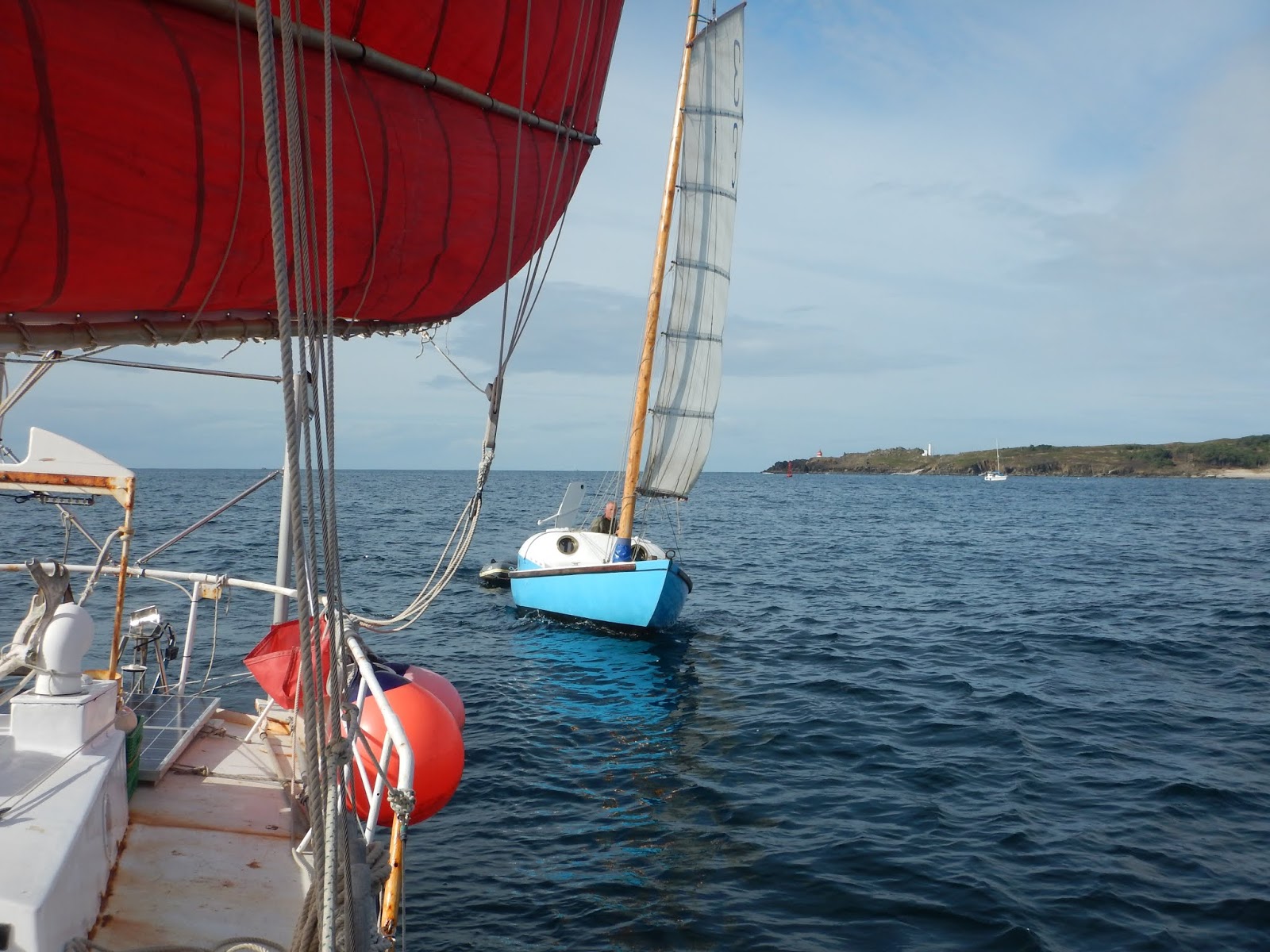
By the time Nomad worked her way around Punta Robaleira Spain the forecast gale force northerlies were beginning to build as the sun set.  I carefully approached the unlit beach in complete darkness with a close watch on the depthsounder. It was a relief to get anchored as there had been little respite from the heavy traffic all the way from England.  When the sun came up the next morning I found that the the only other boat in Enseada Barra was a small junk.  The forecast called for a day of brisk southerlies after the gale so we sailed in company across to Bayona Spain. This was an excellent opportunity for some good photos of each others boats under sail. Sailing with another junk was a rare chance to compare different rigs and see other methods of working our unique boats.
China Blue coming up fast

Nomad, as seen from China Blue

Nomad departed Bayona when the winds changed back to the prevailing northerlies.  But the winds were light offshore and there was a big swell left over from the recent winds.  Nomad was unable to maintain steerage in the troughs where there was no wind so it was time to play motorboat for twenty four hours until the wind and sea state allowed sailing.  After that it was easy sailing, having moved slightly further offshore to get out of the steady stream of traffic  moving along the coast.  Rounding Cabo Sao Vincente  brought Nomad into a different world. The wind became light before stopping altogether, the big Atlantic swell disappeared and the temperature became noticeably warmer. I put the anchor down inside the breakwater in Portimao Portugal five days after departing Bayona.

Sunset in Portimao Portugal.

Portimao was a good city  to restock the boat in and visit. Seeking a quieter, less rolly anchorage I moved east to Culatra. The sea state in the entrance was a bit rough with the wind and tide opposed as I could not go quite fast enough to arrive at slack water. Here was a pleasant anchorage near a small fishing village that could only be reached by boat. The larger town of Olhao was just a dinghy ride across the drying sandbanks. Timing the tides is all important rowing across the sandbanks. One afternoon I lingered a little too long at a waterfront pub and had to get out and walk the dinghy across the sandbanks in not quite enough water to fully float it. Another fifteen minutes and I would have had several miles of rowing to get home!
This looked like  it was a good place to work on the boat, so I dismounted the windvane and got it on deck. I had noticed that the Delrin bearings were falling out of the bottom and decided that it was time to rebuild it. 
This overhaul was way overdue, I had done nothing except replace the plastic bits that got sun rotted and the control lines since I purchased it for my last boat. In1998!
Ready for a complete rebuild.

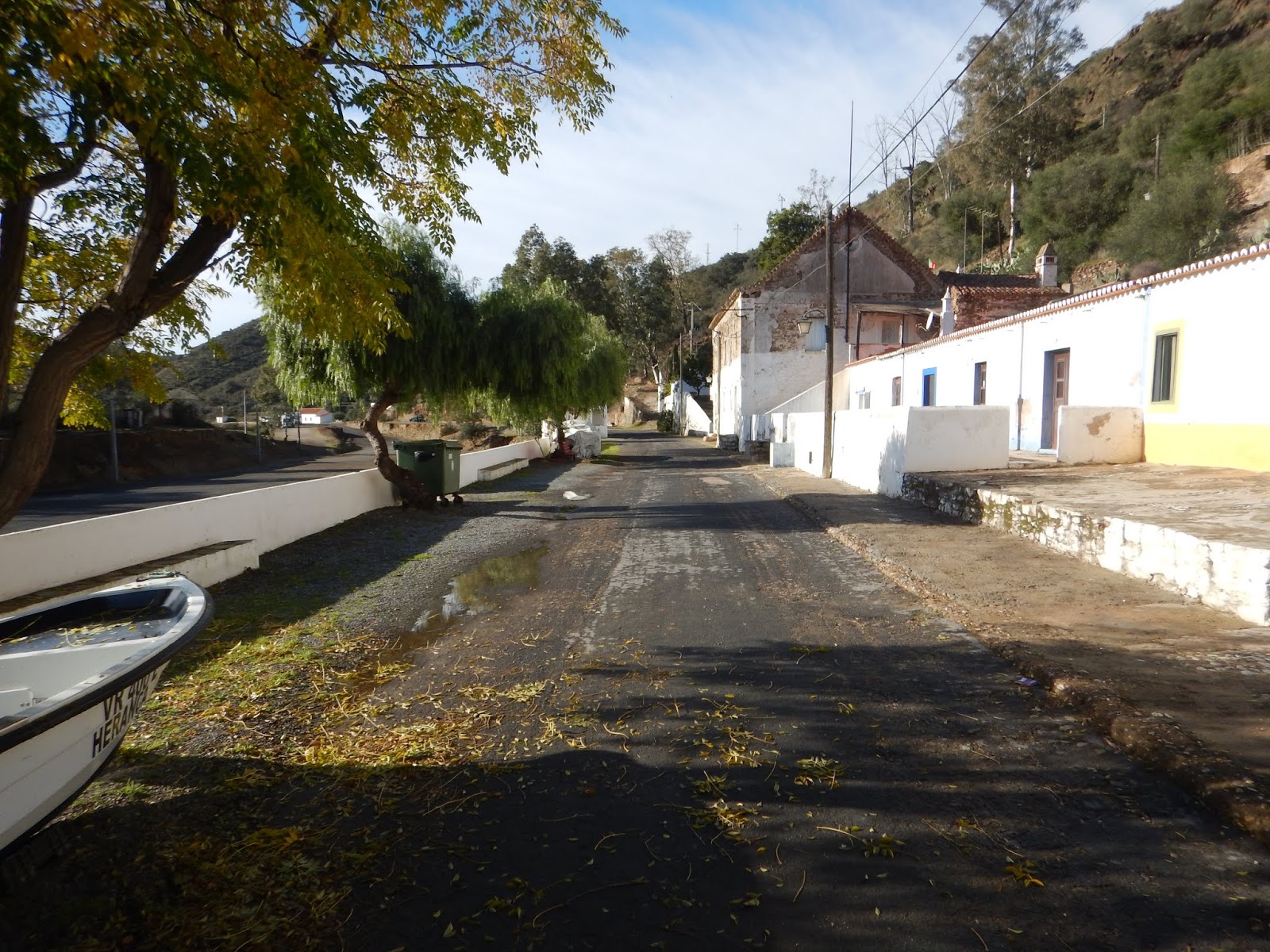
Some time ago I was told to check out the Rio Guadiana by another sailor. This was just a short sail to the Spain-Portugal border so I had no trouble timing arrival for high water. As the tide began to ebb it was time to anchor. I found a comfortable shoal out of the main channel before the bridge across from Ayamonte.  Riding the tide the next afternoon I went upriver to anchor off the twin towns of Alcoutim Portugal and Sanlucar Spain. Two countries, two time zones and two languages split by the Rio Guadiana. This river is  a sailors paradise with no commercial traffic and sailboats anchored everywhere. Village life or wilderness all nearby. There are quite a number of ex sailors living ashore here who arrived on their boats and never left. I thought I would explore the river for a few days before moving on. But the good living and active social life along the riverfront kept me here for well over a month including the Christmas and New Years celebrations.
Sanlucar de Guadiana as seen from Alcoutim


Sailboats everywhere on the Guadiana


Most days started like this.

Talking with people here I learned that it was possible to go with your boat as far upriver as Mertola which is much further than the chart goes. I set off with a copy of a very old guidebook and some notes  to explore the upper river. I moved slowly going hiking at every anchorage .  Eventually I got to a bend in the river and could not locate the channel at high tide. When the tide dropped I could see what I thought was deep water channel was completely blocked by boulders.  The next morning was spent exploring with the dinghy and lead line, finding the deep channel less than two meters from the bank. Getting around this bend at high tide was easy with a quick sketch chart of turning points I made in the dinghy. Nomad anchored further upriver a half mile below the ruins of an old Roman dam near Vau da Vaquiera. Reportedly one can pass over it at high tide. After an investigation with  lead line found that it is deep enough at high tide but there were a few random boulders scattered about  without a straight path through, I decided not to risk scraping up my bottom paint and go the last two miles to Mertola by dinghy. I had to wait for a few days for the tide times to be right to ride the tide up and back during daylight. Two days later a cold front came through with brisk shifting winds and Nomad began to slowly drag her anchor upriver. After several failed attempts to reset the anchor on a bottom that was apparently solid rock I hitched it up and headed downriver to Penha de Aguia to anchor in a nice mud bottom.

Downriver from Penha de Aguia

The remains of an old Roman era dam at Vau da Vaquiera . End of the road for Nomad

Time to start using two anchors in the narrow areas. The wind vane was bumping on the rocks as the tide turned.

Nomad's last anchorage before turning downriver. Three miles from Mertola.

Another spectacular Guadiana anchorage.
Pomerao is a very small village with two restaurants and a riverside parking are popular with caravans.  The big attraction here is the hiking into the countryside along many kilometers of old railways. After the mine closed, the tracks and bridges were dismantled and anything of value was removed. But the tunnels and bridge foundations remain. I spent a few days hiking extensively in the mountains behind Pomerao.
Anchored by Pomerao. Notice the wing dams upriver showing at low tide.

Pomerao

Anchored fore and aft in Pomerao. The boas on the docks were all long term storage with only a few sailors onboard.

Exploring the old railway tunnels.

Pomerao as seen from the highway above town.

Learning of a bamboo grove on the river, I located it and cut some fresh bamboo to replace some damaged battens. Nomad anchored again downstream of Alcoutim to install the new bamboo and work on the never ending fixit list.

With the ninety days allowed in the Schengen agreement countries fast running out and wanting to save a little bit for the Canary islands I reluctantly sailed back to Portimao to get a little fuel and clear out for Morocco.  Before losing the phone signal off shore I got an email from some friends who said they were still in the boatyard in Porto Santo. After a quick check of the weather forecast I changed course for Porto Santo and sent them a note saying that I will see you in a few days. Five days later Nomad was anchored inside the breakwater at Porto Santo. It was a great opportunity to catch up with old friends and do a lot of hiking around the island.  Hiking also provides spectacular views along the forbidding north side of the island which is a dangerous lee shore for boats.
The harbour at Porto Santo. In the background, Madeira on the right and Ilhas Desertas on the left.

The ocean is nearly always in sight on Porto Santo.

Porto  Santo's rugged north shore.

All to soon it was time to head for Gran Canaria and points south. There were still a few ports I wanted to visit enroute to The Gambia.  But the more time I spent enroute meant that the was less time available  for visiting The Gambia as I wanted to sail from there before the rainy season began.